
A Globe In Your Pocket
Today, we don’t even think about how our phone knows where we are. We open a map, and there’s a dot on the screen. It’s like magic. But under the hood, there’s a complex system where satellites, networks, servers, and algorithms work together to understand: whether you’re standing at a subway exit, in a park, or in a different country.
Geolocation has long ceased to be something that only cartographers use. It’s not about geography, but about technologies that quietly help us navigate the world every day, collecting tons of data that most people don’t even realize exists.
What is Geolocation?
Simply put, geolocation is a way to determine the location of an object in the real world. This can be anything from a person, phone, car, server, package, or even an IP address.
There is a more precise definition: geolocation is the process of establishing the geographical coordinates of an object using technical means. However, “geographical” does not necessarily mean “precise to the meter.” Sometimes, it is sufficient to know the city or at least the country.
How It Works: The Main Approaches
There are various ways to determine a location. Each method has its own advantages and limitations. Here are the main approaches:
GPS – The Classic of Satellite Navigation
This is what is built into almost every smartphone. The device receives signals from multiple satellites and uses the time difference to determine its location. It works well outdoors, with an accuracy of just a few meters.
However, GPS can fail indoors, in subways, or under thick clouds. For these situations, other technologies have been developed.
Wi-Fi Geolocation – When Satellites Are Not Visible
The phone scans the surrounding Wi-Fi networks, compares them with a huge database (for example, Google’s), and finds itself on a map. Even if the network is password-protected, the mere presence of the network provides a clue to the system.
The more Wi-Fi networks there are, the more accurate the result will be. In a large city, this can be even more accurate than GPS.
IP Geolocation is the Simplest and Coarsest Method
When devices go online, they use an IP address — a digital “plate” like an apartment number. It can be determined from which city or country the connection is coming from. Sometimes even the exact district, if the provider gives such data.
But the reliability here is different. In Moscow, the IP can definitely “get”, and somewhere in the middle of nowhere — show a neighbouring region or even another area.
Geolocation By Mobile Network
If the GPS is turned off and there is no Wi-Fi, the smartphone can still be found using the signal from the cell towers. It connects to the nearest tower, and the system determines the coordinates based on this tower. If there are multiple towers in the area, the accuracy increases.
Indoor Space: Bluetooth and Beacons
Inside buildings, where neither satellites nor cell towers can provide assistance, special beacons are used. These beacons transmit short signals that can be detected by phones and other devices. This way, you can accurately determine where a person is located within a museum, store, or even an office.
Different Types of Geolocation
Not all geolocation is equally useful, as it depends on the purpose and what it determines.
- Coarse (macro): Country, city, or sometimes neighborhood level. Based on IP or mobile data.
- Precise (micro): down to the house, the entrance, a specific point. Uses GPS, Wi-Fi or Bluetooth.
It can also be classified by the type of access:
- Active – when the user himself allows tracking (for example, in an application).
- Passive – the system receives data without human intervention (for example, through a server or browser).
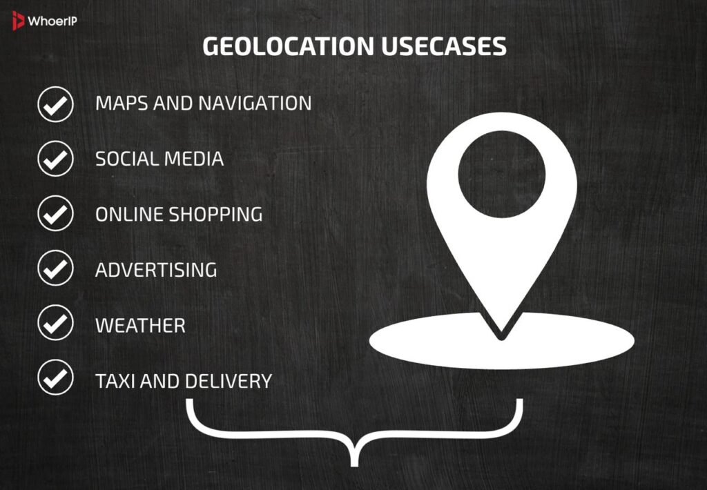
Where We Encounter Geolocation Every Day
Geolocation has long become part of the digital background. Here’s where it’s found, even if you don’t notice it:
- Maps and navigation – obvious. Without it, Google Maps is just useless.
- Social media – when you mark where a photo was taken or see “popular places nearby.”
- Online shopping and advertising – city targeting, delivery, and “Moscow-only” promotions.
- Weather – automatic location determines which forecast to show.
- Taxi and delivery services — driver tracking, route calculation, and arrival point.
Geolocation Precision
| Method | Precision | Pros | Cons |
|---|---|---|---|
| GPS | 1–5 meters (outdoor) | Highly accurate, global coverage | Poor indoor performance, battery drain |
| Wi-Fi | 5–50 meters | Works indoors, fast location | Requires Wi-Fi networks, urban bias |
| GSM (Cellular) | 100–1000+ meters | Wide coverage, works without GPS | Low precision, depends on tower density |
| IP Address | 1–50 km (city/country) | No hardware needed, works remotely | Very imprecise, easily spoofed |
| Bluetooth | 1–10 meters (beacons) | High precision indoors, low power | Short range, requires beacons/setup |
A lot depends on the conditions: the density of the building, the weather, the quality of the reception, even the charge of the device.
Geolocation And IP: The Common Language of the Internet
When it comes to websites and browsers, everything revolves around IP addresses. These are what allow systems to determine the user’s location in some way, without access to GPS or Wi-Fi.
IP geolocation is the basis for local advertising banners, suspicious login warnings, website language selection, and even regional restrictions.
Browsers and Geolocation: Who Asks Who
When a website requests your location, the browser’s built-in mechanism kicks in:
- The website sends a request.
- The browser asks you, “Allow access to your geolocation?”
- If you agree, your coordinates are shared. If not, the site works as it knows how, by IP.
It is interesting that the browser can use several sources at once – Wi-Fi, GPS, IP, connection history – and give the most accurate estimate.
The Privacy Question: Who Needs It All?
Geolocation is not just a convenience. It is also a tracking tool, no matter how unpleasant it may sound. The more data about the device, the more accurately it is possible to determine where you were, when and with whom. This means that access to geolocation is a matter of privacy and user rights.
In Europe and other regions, there are strict regulations in place (GDPR, the General Data Protection Regulation). Services are required to:
- ask for permission;
- explain why they need the data;
- provide an option to opt out.
Geolocation in the Future: More Accurate, Deeper, and Smarter
In the coming years, we can expect a new era of geolocation. It will no longer be just “where are you”, but:
- Behavioural analytics – how you move, where you most often enter.
- Geofences (geofencing) – the system’s reaction to entering/leaving a given area.
- Contextual actions – for example, automatic opening of a barrier at the office.
And all this without unnecessary actions on the part of the user. The system will “guess” your steps by habits, routes, schedule. Both Google and Yandex Maps are already testing such formats.
Geolocation Conclusion
Geolocation is like air in the digital world: we can’t see it, but it affects almost everything. It’s built into navigation, services, security, and analytics. It can be accurate or approximate, useful or intrusive, transparent or hidden.
Understanding how it works is essential for comprehending the essence of the digital environment. Behind every point on a map lies something more: a system, a solution, or an interest. And it all starts with the question: Where are you?